
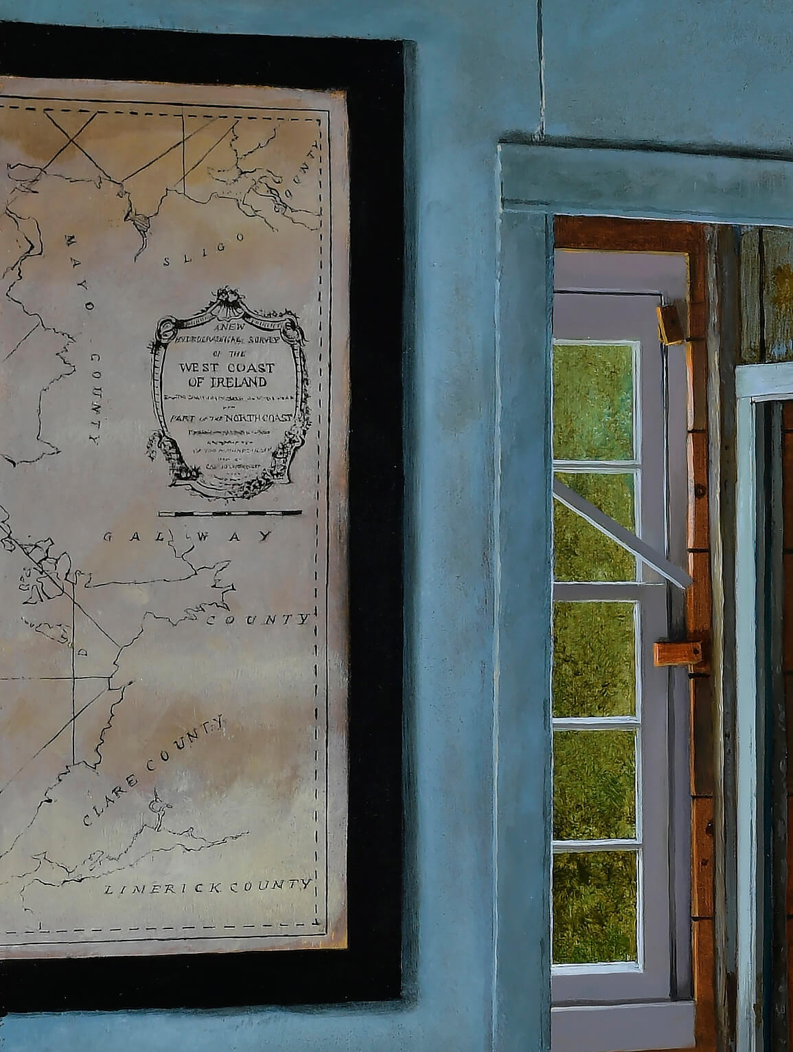
Map Room – 24 x 26
There’s a whole lot of maritime history to be witnessed in this little room
Hanging left and right are copies of centuries old nautical maps and charts which were discovered in the attic of the Hancock Mitchell House when the Sheriff’s Meadow Foundation began its restoration.
Having recently trodden my own path along the rugged Wild Atlantic Way, I am choosing the map of the West Coast of Ireland to feature in detail here…
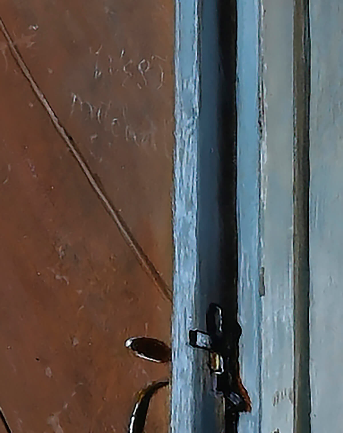
Martha’s Vineyard, Nantucket and New Bedford were at the center of the whaling industry in the mid 1800’s. Several whaling ship captains came from this homestead in Quansoo. One of whom was West Mitchell…
I have lifted these lines from a 2017 article by Alex Elvin in The Vineyard Gazette, click here for direct link to read the entire piece…HERE.
Capt. West Mitchell, who once lived in the house, was among those who weathered the whaling disaster of 1871, when dozens of whaling ships from the region became stranded in the Arctic. He was captain of the barque Massachusetts, which now lies at the bottom of the Arctic Ocean.
Mr. Mitchell’s name remains scratched into a wall in the Quansoo house, barely visible above the stairs leading to the attic.
Here indeed is that very mark…
I found more information on The Whaling Disaster of 1871 on Wikipedia…click here to read.
This one ticks all the boxes for me…
centuries of living on the island
talismans left for us to puzzle
maps to point the way
salt and brine soaked patina
on wood worked by hand
passages in
and passages out
and always and ever
our return…to the sea.